While the official Trans Canada Trail map is likely the best place to begin when considering a journey anywhere along the TCT, it can be a little confusing without any context. This page of the website aims to provide some details about how the trail works from coast to coast. While it is not a comprehensive guide, the maps and trail routes included here might offer some insight into how consider to making a transcontinental or regional journey along the Trans Canada Trail.
First, the Trans Canada Trail, according to the offical map, is not a transcontinental path exclusively laid out for people on foot, horse, or recreational vehicle. Much of the designated cross country trail is comprised of roadways(orange) and waterways(blue), along with nature paths(green). These sections are easily found when zooming in on the Interactive Map at tctrail.ca
Finding the designated walking and recreational paths is not necessarily an easy task even with maps and it helps to understand how the trail operates in different parts of the country. While many sections of the trail are very well maintained with elaborate staging, rest areas, and other facilities, some sections are more accurately regarded as unmarked nature trails.
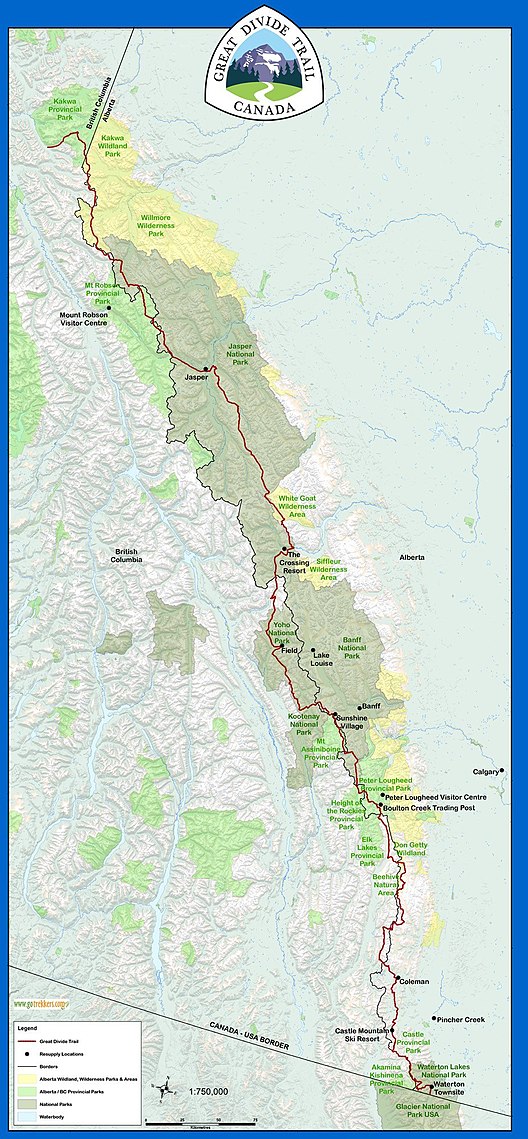
Much of the 1100km Great Divide Trail through the Rockies between BC and Alberta is seen as such, and therefore should require the expertise of experienced hikers or professional guides to attempt to traverse it safely.

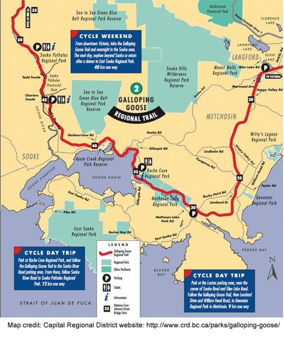
THE GALLOPING GOOSE
In and around Victoria on Vancouver Island one will find a much more developed and accessible section of the TCT, known as the Galloping Goose trail, where a lot of the foot / bike paths are paved with painted markers and abundant signage that connect urban spaces. And, of course, as an island, Vancouver Island is separated from the main part of the continent, so much like Prince Edward Island or Newfoundland, a boat or plane ride is necessary to connect the trail from or to these parts of Canada.
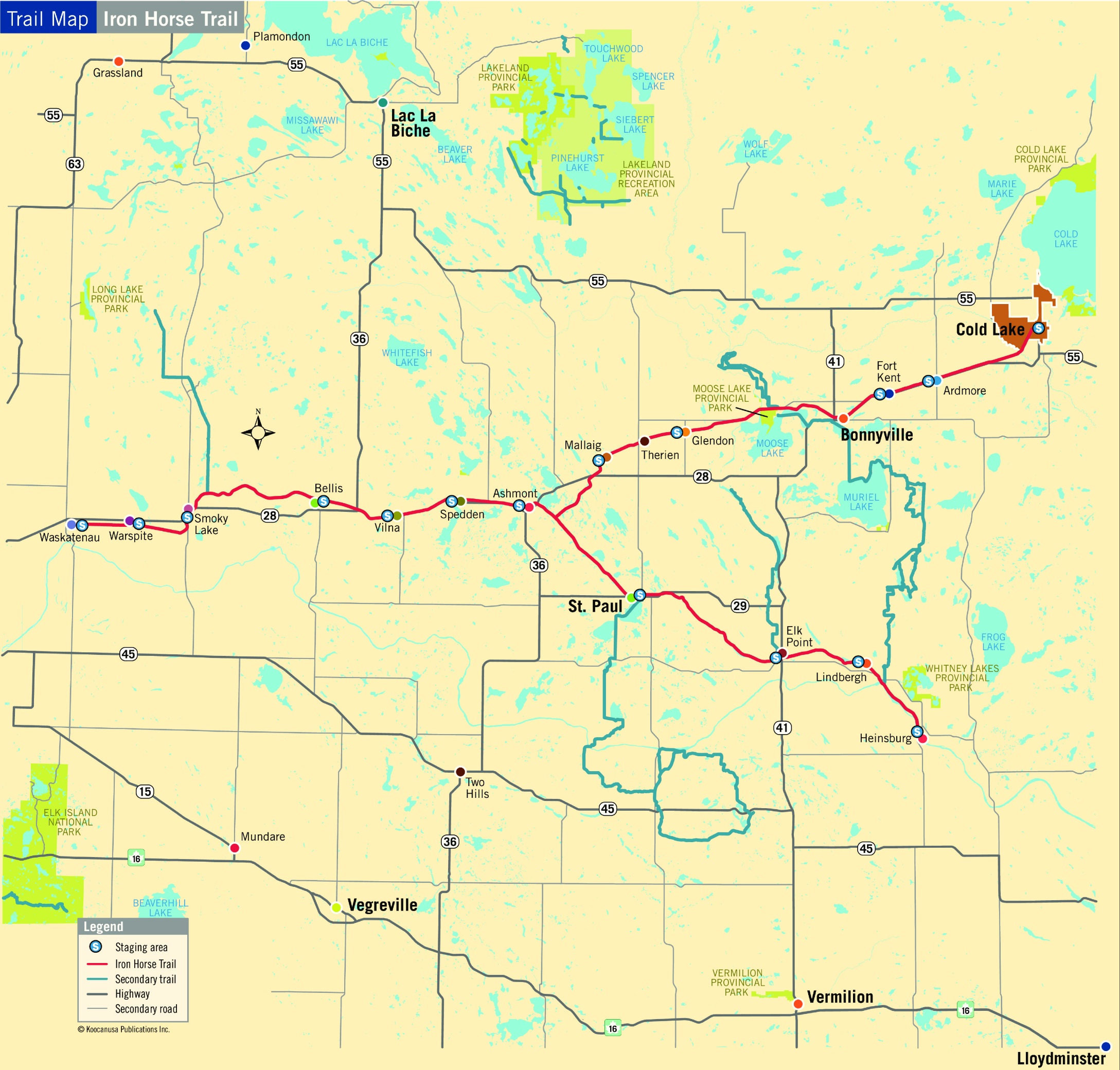
IRON HORSE TRAIL
Alberta boasts one of the longest section of uninterrupted recreational trail in the country. Known as the Iron Horse Trail and only open to people on foot, horse, atv, and snowmobile, this pathway extends over 300kms along a repurposed rail line between Waskatenau 90kms north of Edmonton and Heinsberg and/or Cold Lake, both near to the border with Saskatchewan.
In order to access the Iron Horse Trail for the purpose of a cross country journey on foot it is virtually impossible to do so without walking along highway sides, though there are some abandoned rail lines that are accessible for walking from east to west or vice versa. This is the case in every province where long stretches of railway have been decommissioned, repurposed, or left to the elements.
A good source for maps of abandoned rail lines in Canada:
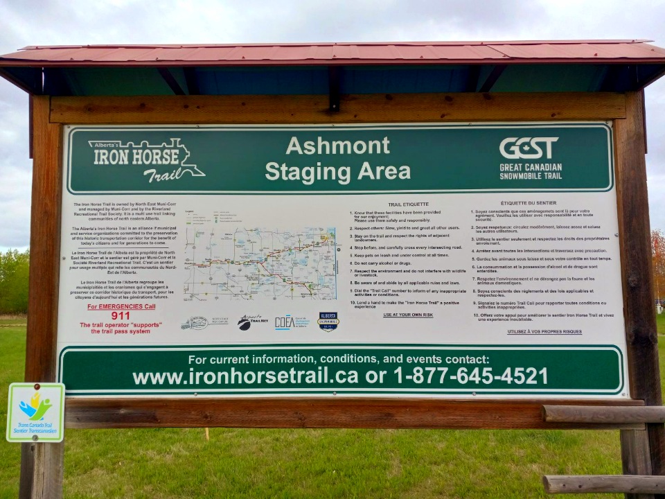
At each of the main pavillions or townships along the Iron Horse Trail a large trail map is displayed which helps while on route.
Straddling the border of Alberta and Saskatchewan is the town of Llyodminster.
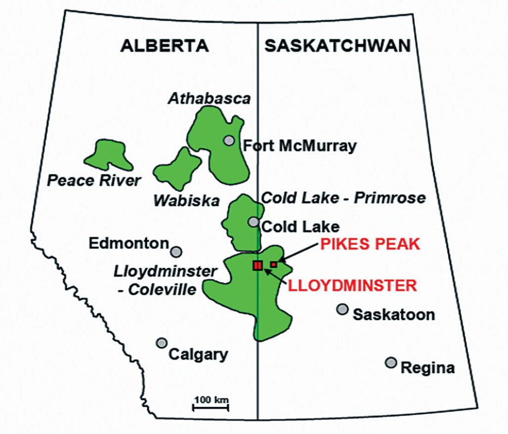
Walking through Llyodminster it is possible to cover a notable portion of the cross country trip while Traversing the city sidewalks between the two provinces. Leading up to Llyodminster on both sides is the transcanada highway, making it necessary to walk beside the road if approaching the border of Alberta and Saskatchewan on foot. These sections of the route are largely surrounded by farmlands which make the shoulder of the highway the only real option for walking without trespassing on private property. The shoulders here are wide, often with wide flat drainage ditches that can be good for walking if it’s not too wet.
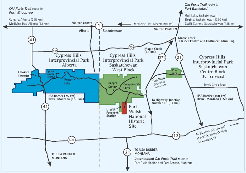
Cypress Hills
Alternatively, the Cypress Hills Inter Provincial Park offers another route for walking over the Saskatchewan and Alberta border. Extending 32kms between the 2 provinces the Cypress Hills Inter Provincial Path is 40kms due south of Lyoddminster and 10kms north of Canada’s southern boarder with Montana. Much like reaching the sidewalks of Lyodd accessing Cypress Hills requires travelling over paved road ways.
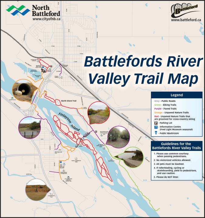
Leading into Saskatchewan the first major section of Trans Canada Trail is found in North Battleford:
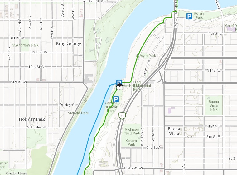
After North Battleford, the next major section of trail is in and around Saskatoon, with much of the distance in between being a paved roadway. The trails in Saskatoon travel throughout the city over the South Saskatchewan river and to the edges of greater Saskatoon. Much like in Saskatoon, a Pavillion marks the Trans Canada Trail entrance in Regina, and the pathways are often paved, or compacted quarry dust marked with well signed paths that connect urban spaces through an abundance of parklands. In the larger cities and towns across the country it is easy enough to create a unique pathway using the sidewalks to travel east or west that is not necessarily part of the designated TCT.
From Saskatoon south easterly toward Regina it is approximately 250kms of uninterrupted prarie highway surrounded by farmlands and a few small hamlets. The highway shoulders and drainage ditches along this stretch are very wide and flat offering what is likely the best west-east footpath through central Saskatchewan to Regina.
Qu’appelle Valley
Approximately 75kms northeast of Regina is Fort Qu’appelle and the Qu’appelle Valley region. To reach Fort Qu’appelle on foot requires walking along the highway side and once there roughly 50kms of nature trails run around Echo Lake and 9kms northeast of Fort Qu’appelle into the town of Lebret.
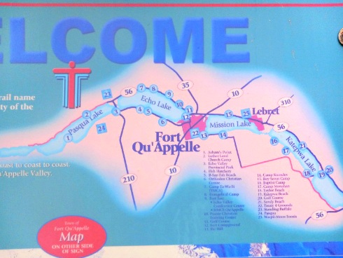
From Lebret and towards the Manitoba border the trail becomes roadway again with sections of nature trail designated as parts of the TCT in towns along the way.
Manitoba
There are an abundance of expansive nature trails in Manitoba’s provincial parks and the trails in downtown Winnipeg follow some of the main arteries of the region’s early history.
Ontario & Quebec
As the two largest provinces in Canada, Ontario and Quebec have countless trails, pathways, routes and waterways running east/west/north/south that work to connect the Trans Canada Trail with the help of paved roadways. In an effort to keep this guide simple only a few of these are listed here.
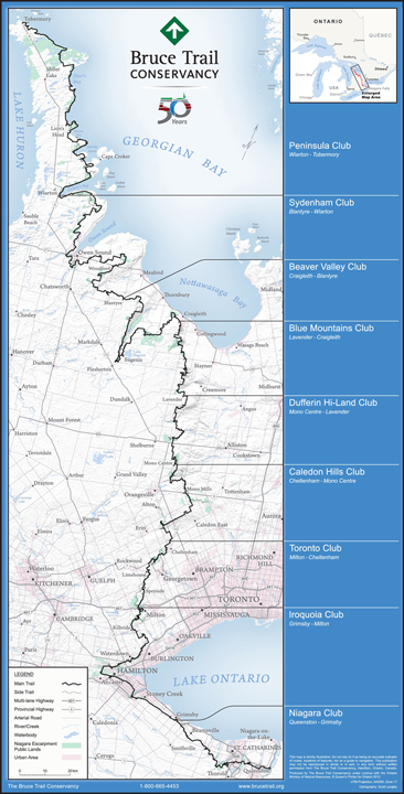
The Bruce Trail
Canada’s oldest marked trail extends over 900kms north-south along the Niagra Encarpement, a UNESCO designated heritaged site.
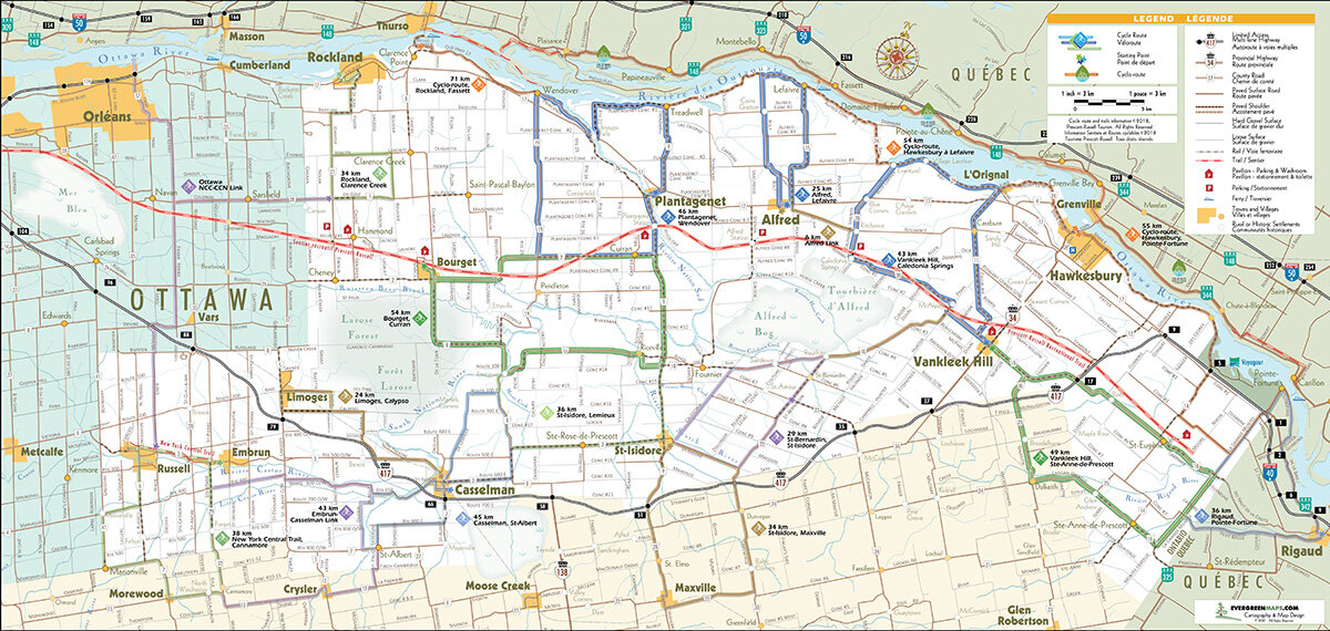
Russell-Prescott Trail Link
The Russell Prescott Trail Link, which runs from Hammond on the easterly edge of greater Ottawa to Rigaud, Quebec, is a nearly 100km stretch of repurposed trail line that offers the opportunity to walk over the border between the two provinces. On the outer edge of Montréal’s public transit system, arriving in Rigaud makes the vast trail systems of Montréal’s much more accessible.
Le Sentier de L’Etoile
400kms along the eastern coast of New Brunswick Le Sentier de L’Etoile is a nature path that travels from Miramchi to Caraquet offering stunning views of the Atlantic.
nova scotia
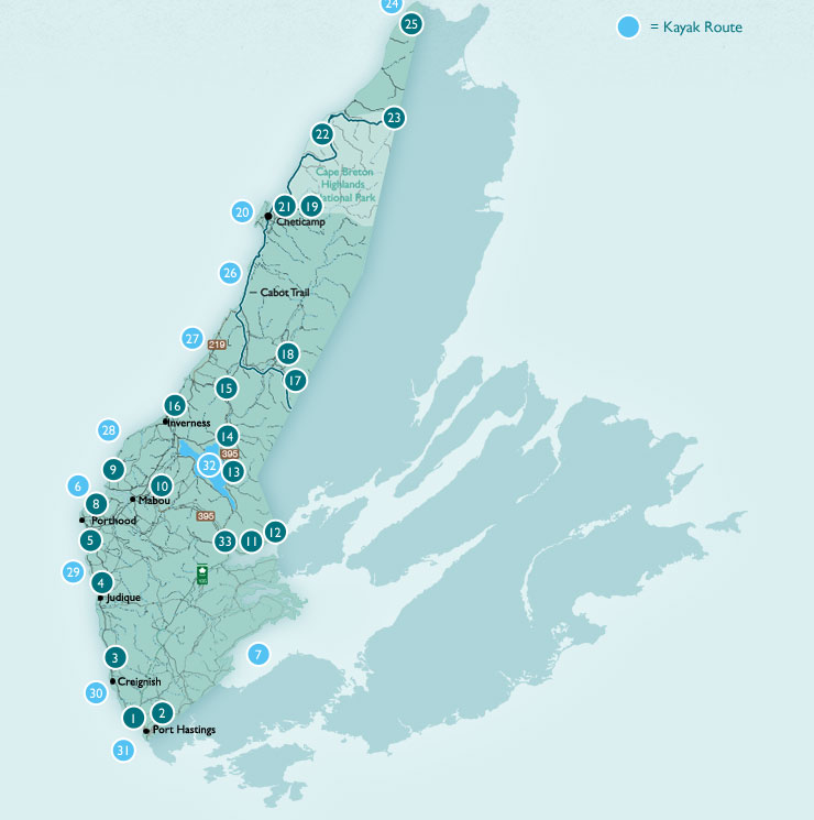
In Nova Scotia, much like the other provinces, sections of Trans Canada Trail are scattered throughout the provinces with the Celtic trail in Cape Breton among the most visited in the country.
newfoundland
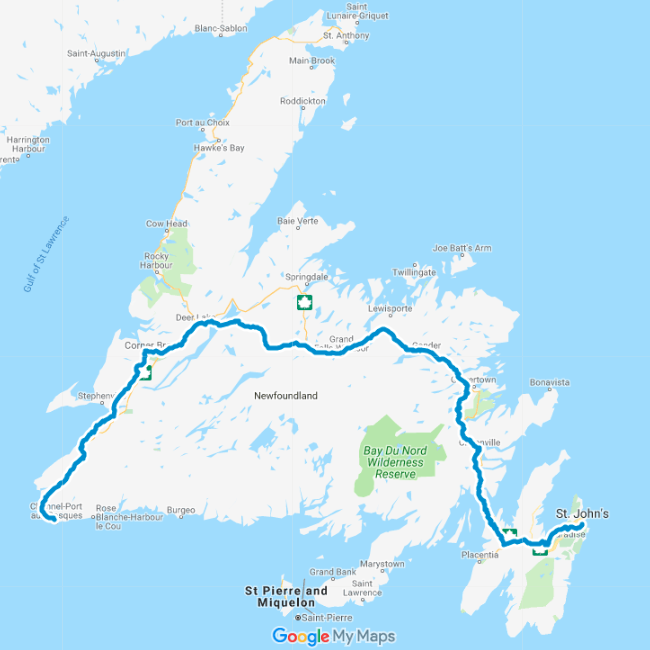
The Great T’Rail in Newfoundland extends over 800km along an old rail path the full width of the province. It is possible to follow the path on foot which has exposure to some the most the remote parts of central Newfoundland.
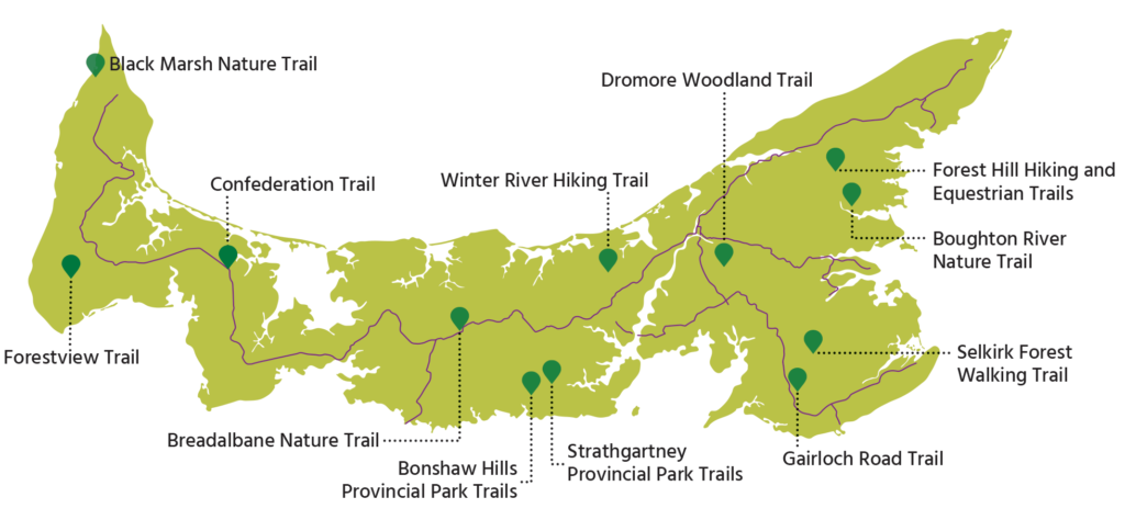
Much like in Newfoundland, the Trans Canada Trail in Prince Edward Island extends the full length of the region’s land mass with well developed pathways for biking and walking.